01Walking
Ginzling · Schlegeis
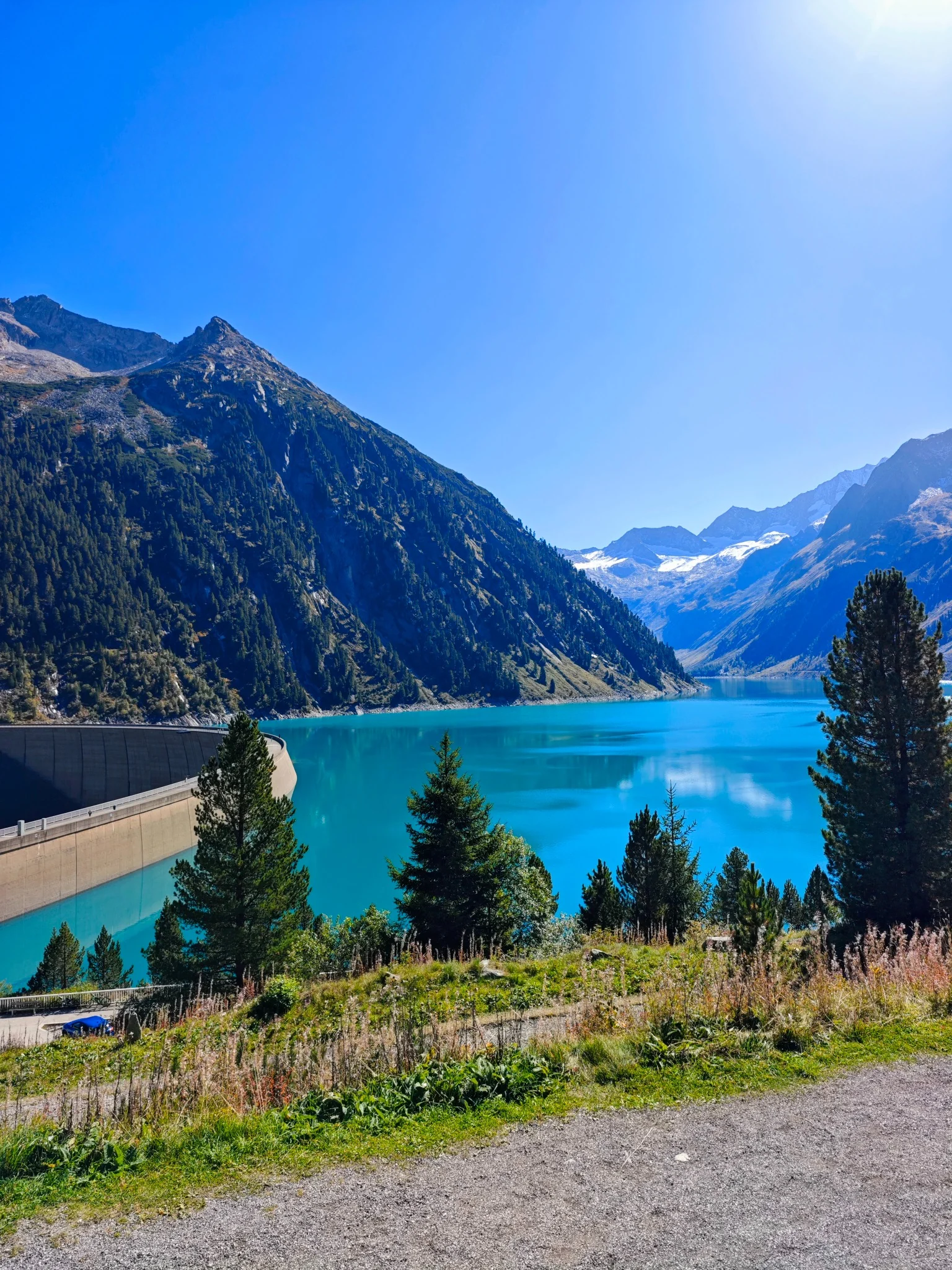
Schlegeis: turquoise water and a day by the dam
The dam and reservoir shore make a mountain day in their own right; there is no need to add another summit.
On our radar · editorial recommendation
Editorial day plan
Your day and practical details +
Why go
The dam and reservoir shore make a mountain day in their own right; there is no need to add another summit.
Who it suits
A slower day outdoors, with the option to turn back early.
How to plan the day
- Schlegeis dam
First check access and weather conditions.
- Reservoir shore
Choose a safe stretch and return the same way.
- Start → finish
- Schlegeis dam → Reservoir shore
- Type
- An editorial sequence of stops, not a surveyed continuous route
- Time including stops
- Our suggested allowance: half a day to a full day, including travel between stops.
- Difficulty
- Difficulty depends on your chosen distance and current ground conditions; we cannot promise wheelchair or pushchair suitability.
- Season
- Subject to current weather and the opening arrangements of the places listed.
Practical details
Set aside a separate day for Schlegeis. In 2026, the operator plans to keep the road open until 26 October; from 13 October, the published hours are 7:00–17:00, subject to weather-related changes. Olpererhütte is closed, so do not count on it as a lunch stop. An open road does not confirm that mountain paths are passable.
What to bear in mind
Olpererhütte is closed; do not automatically include it as a lunch stop or assume the hike is possible. An open road does not mean mountain trails are safe.
A shorter option
Just the dam and a short stretch of shore.
When the weather changes the plan
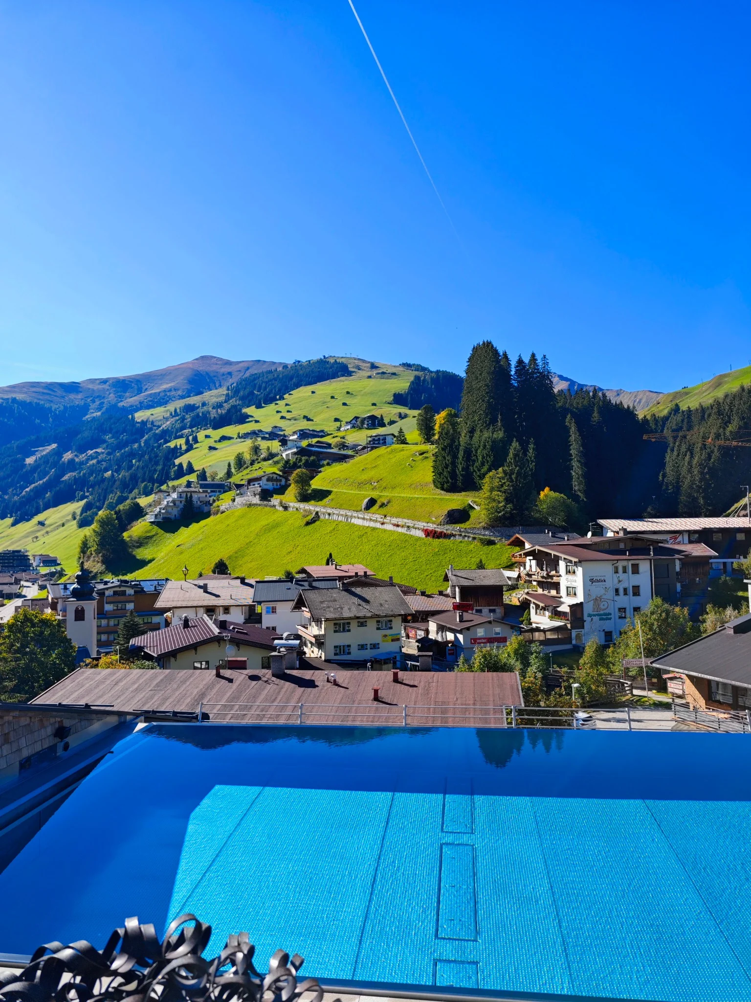
Naturparkhaus in Ginzling only during confirmed opening hours; on an autumn weekend, hotel wellness is a better fallback.
What to combine it with
Sources and checks · 2026-10-17
On our radar means selected through editorial research, but not yet visited personally. The check date refers to the listed sources; it does not guarantee today’s opening or operating conditions.
02Walking
Finkenberg · Penkenjoch
Penkenjoch and Granatkapelle
A chapel, still water and views brought together in a gentler mountain outing.
On our radar · editorial recommendation
Editorial day plan
Your day and practical details +
Why go
A chapel, still water and views brought together in a gentler mountain outing.
Who it suits
A slower day outdoors, with the option to turn back early.
How to plan the day
- Finkenberger Almbahnen
Check both sections of the cable car and the last descent.
- Penkenjoch and Granatkapelle
Choose your short walk according to surface conditions and visibility.
- Top station
Return with time to spare.
- Start → finish
- Finkenberger Almbahnen valley station in Finkenberg → The same valley station after the cable-car descent
- Type
- An editorial sequence of stops, not a surveyed continuous route
- Time including stops
- Our suggested allowance: half a day, including the ascent and return; walking time alone is not the duration of the whole outing.
- Difficulty
- Difficulty depends on your chosen distance and current ground conditions; we cannot promise wheelchair or pushchair suitability.
- Season
- Subject to current weather and the opening arrangements of the places listed.
Practical details
For a shorter outing, take the lifts all the way to Penkenjoch and walk to Granatkapelle. Do not confuse this with the longer circuit via the middle station and another cable car. Finkenberger Almbahnen lists summer operation until 26 October 2026, usually 8:45–16:30; weather may change the plan. Check the last descent before going up.
What to bear in mind
At around 2,000 metres, expect the possibility of wind, snow and ice. Do not squeeze Penken and Schlegeis into one short day. The short walk from the top station is not the official 6.6 km circuit via the middle station and another cable car. Eggalm has already ended its summer season; Rastkogel has no summer service.
A shorter option
Stay near the station.
When the weather changes the plan
A café and a walk around Mayrhofen; fog is a poor backdrop for a summit outing.
What to combine it with
Sources and checks · 2026-10-17
On our radar means selected through editorial research, but not yet visited personally. The check date refers to the listed sources; it does not guarantee today’s opening or operating conditions.
03Walking
Hintertux
Hintertux: panoramic views or a full day on skis
The viewing terrace at 3,250 metres and a day of skiing are two different outings.
On our radar · editorial recommendation
Editorial day plan
Your day and practical details +
Why go
The viewing terrace at 3,250 metres and a day of skiing are two different outings.
Who it suits
A sightseeing ascent when conditions allow, or a separate ski day; this is not an easy walking route across the glacier.
How to plan the day
- Hintertux valley station
Check live operating information and webcams.
- Panoramic terrace
Only in suitable conditions and while the lifts are operating.
- Hintertux
Return to the valley.
- Start → finish
- Hintertux valley station → Hintertux
- Type
- An editorial sequence of stops, not a surveyed continuous route
- Time including stops
- Our suggested allowance: half a day for the sightseeing ascent; a separate full day for skiing.
- Difficulty
- Difficulty depends on your chosen distance and current ground conditions; we cannot promise wheelchair or pushchair suitability.
- Season
- Subject to current weather and the opening arrangements of the places listed.
Practical details
Plan Hintertux either as a sightseeing ascent or as a separate ski day. Before setting off, check live lift and piste information and the webcams. Year-round resort operation does not mean the same skiing conditions every day or a guaranteed view. Our snowy photographs were taken in December 2025.
What to bear in mind
This is not permission to walk freely on the glacier. Wind can stop the lifts; warm layers and sun protection are necessary.
A shorter option
A valley-only outing, adapted to the weather.
When the weather changes the plan
Stay down in the valley; the glacier is not an all-purpose rainy-day outing.
What to combine it with
Sources and checks · 2026-10-17
On our radar means selected through editorial research, but not yet visited personally. The check date refers to the listed sources; it does not guarantee today’s opening or operating conditions.
04Hiking
Hintertux
Hintertux waterfall circuit
Water, woodland and rock formations on an official short circuit above Hintertux.
On our radar · editorial recommendation
3.5 km↗ 260 mRoute with an official source
Your day and practical details +
Why go
Water, woodland and rock formations on an official short circuit above Hintertux.
Who it suits
A hiking day suited to your fitness and the actual conditions.
How to plan the day
- Hintertux Gletscherbahn
Start as shown on the official map.
- Kesselfall and Walfischmaul
Follow trail numbers 16/526, then 14.
- Waldeben
Return to the starting point along trail 16.
- Hintertux Gletscherbahn
End of the circuit.
- Start → finish
- Hintertux Gletscherbahn → Hintertux Gletscherbahn
- Type
- Verified route based on the official source listed below
- Time including stops
- Our suggested allowance: 3–4 hours, including stops.
- Moving time stated by the source
- Approximately 2 hours according to the source.
- Difficulty
- Moderate difficulty, with wet rocky sections.
- Surface
- Woodland and mountain paths, gravel.
- Season
- Subject to current weather and the opening arrangements of the places listed.
Practical details
Follow the version in the official route description: 3.5 km, +260 m, approximately 2 hours of walking.
What to bear in mind
Wet rocks and footbridges can be slippery. This is not a pushchair-friendly promenade.
A shorter option
Just the safe approach to Kesselfall and back.
When the weather changes the plan
Skip the circuit; plan coffee and wellness in the valley.
Sources and checks · 2026-10-15
On our radar means selected through editorial research, but not yet visited personally. The check date refers to the listed sources; it does not guarantee today’s opening or operating conditions.
- Hintertux waterfall circuit — official source ↗
- Follow the version in the official route description: 3.5 km, +260 m, approximately 2 hours of walking.
- Wet rocks and footbridges can be slippery. This is not a pushchair-friendly promenade.
05Walking
Tuxertal
Along the Tuxbach: through the valley to Hintertux
A longer valley walk that lets you explore the spaces between the hotel villages.
On our radar · editorial recommendation
10.2 km↗ 356 mRoute with an official source
Your day and practical details +
Why go
A longer valley walk that lets you explore the spaces between the hotel villages.
Who it suits
A slower day outdoors, with the option to turn back early.
How to plan the day
- Vorderlanersbach
Start of the valley trail.
- Madseit
Continue along signed trails 10, 12 and 11.
- Hintertux Gletscherbahn
End of the one-way route.
- Start → finish
- Vorderlanersbach → Hintertux Gletscherbahn
- Type
- Verified route based on the official source listed below
- Time including stops
- Our suggested allowance: 4–5 hours with stops, plus the return journey.
- Moving time stated by the source
- 3 hours according to the source.
- Difficulty
- A longer valley walk with a gradual ascent.
- Surface
- Wider gravel paths, some tarmac and road crossings.
- Season
- Subject to current weather and the opening arrangements of the places listed.
Practical details
The verified route is 10.2 km with +356 m of ascent and a stated time of 3 hours. Check the return timetable for bus 4104 for your travel day.
What to bear in mind
The return journey is not included in the distance. There are road crossings; pushchair access along the entire route is not guaranteed.
A shorter option
Choose just one stretch between two villages, with your return journey checked in advance.
When the weather changes the plan
A local café and activities at your hotel; postpone the riverside walk in heavy rain.
What to combine it with
Sources and checks · 2026-10-15
On our radar means selected through editorial research, but not yet visited personally. The check date refers to the listed sources; it does not guarantee today’s opening or operating conditions.
06By bicycle
Mayrhofen · towards Zell am Ziller
Cycling in Zillertal from Mayrhofen
Valley cycling with a turnaround point of your choice and coffee back in Mayrhofen.
On our radar · editorial recommendation
Editorial day plan
Your day and practical details +
Why go
Valley cycling with a turnaround point of your choice and coffee back in Mayrhofen.
Who it suits
A day of cycling with your return journey planned separately.
How to plan the day
- Mayrhofen
Start down in the main valley.
- Towards Zell am Ziller
Choose a section of the official Zillertal Radweg that suits your fitness.
- Mayrhofen
Return the same way and stop at Kostner.
- Start → finish
- Mayrhofen → Mayrhofen
- Type
- An editorial sequence of stops, not a surveyed continuous route
- Time including stops
- Our suggested plan takes half a day; allow a full day if adding a longer indoor visit.
- Difficulty
- Difficulty depends on your chosen distance and current ground conditions; we cannot promise wheelchair or pushchair suitability.
- Season
- Subject to current weather and the opening arrangements of the places listed.
Practical details
The full Strass–Mayrhofen route is approximately 31 km; this shorter plan does not inherit that distance. Use the map at maps.zillertal.at.
What to bear in mind
The road down from Tux is not part of this gentle valley ride. Use a trekking bike or e-bike; a fully paved surface is not guaranteed throughout the selected section.
A shorter option
Turn around earlier if your energy calls for it.
When the weather changes the plan
Erlebnissennerei, after confirming visitor opening hours.
What to combine it with
- Café Tirol →
Combine these within a separately planned day; confirm transport between the addresses for your chosen itinerary.
- Kostner Heimat →
Combine these within a separately planned day; confirm transport between the addresses for your chosen itinerary.
- Erlebnissennerei Zillertal →
Combine these within a separately planned day; confirm transport between the addresses for your chosen itinerary.
Sources and checks · 2026-10-15
On our radar means selected through editorial research, but not yet visited personally. The check date refers to the listed sources; it does not guarantee today’s opening or operating conditions.
- Cycling in Zillertal from Mayrhofen — official source ↗
- The full Strass–Mayrhofen route is approximately 31 km; this shorter plan does not inherit that distance. Use the map at maps.zillertal.at.
- The road down from Tux is not part of this gentle valley ride. Use a trekking bike or e-bike; a fully paved surface is not guaranteed throughout the selected section.
07Culture
Ginzling 239
Ginzling: hidden treasures indoors
Minerals and mountain stories during a focused visit to the nature park.
On our radar · editorial recommendation
Editorial day plan
Your day and practical details +
Why go
Minerals and mountain stories during a focused visit to the nature park.
Who it suits
A visit that gives one monument or museum the time it deserves.
How to plan the day
- Naturparkhaus Ginzling
The Verborgene Schätze exhibition.
- Café Rast
A stop subject to opening hours; the garden only in suitable weather.
- Start → finish
- Naturparkhaus Ginzling → Café Rast
- Type
- An editorial sequence of stops, not a surveyed continuous route
- Time including stops
- Our suggested allowance: 2–3 hours plus travel.
- Difficulty
- Urban walking; check steps and accessibility at each indoor attraction.
- Season
- Subject to current weather and the opening arrangements of the places listed.
Practical details
Autumn 2026 timetable: Monday–Thursday 8:30–12:00 and 13:00–17:00, Friday 8:30–12:00; closed at weekends and on public holidays. Confirm before travelling.
What to bear in mind
This is not a reliable weekend rainy-day alternative. Plan a separate journey from Tux.
A shorter option
Just the exhibition.
When the weather changes the plan
The exhibition is indoors; if it is closed, choose a café or wellness where you are staying.
Sources and checks · 2026-10-15
On our radar means selected through editorial research, but not yet visited personally. The check date refers to the listed sources; it does not guarantee today’s opening or operating conditions.
- Ginzling: hidden treasures indoors — official source ↗
- Autumn 2026 timetable: Monday–Thursday 8:30–12:00 and 13:00–17:00, Friday 8:30–12:00; closed at weekends and on public holidays. Confirm before travelling.
- This is not a reliable weekend rainy-day alternative. Plan a separate journey from Tux.
08Hiking
Pustevny
Pustevny: Jurkovič, Radegast and perhaps Radhošť
Timber architecture and a day on the ridge, without having to decide your full distance first thing in the morning.
On our radar · editorial recommendation
Editorial day plan
Your day and practical details +
Why go
Timber architecture and a day on the ridge, without having to decide your full distance first thing in the morning.
Who it suits
A hiking day suited to your fitness and the actual conditions.
How to plan the day
- Pustevny
Libušín and Maměnka, subject to visiting arrangements.
- Radegast
Decide whether to continue based on the weather.
- Radhošť or turn back
The longer option needs enough time for the return walk.
- Start → finish
- Pustevny → Radhošť or turn back
- Type
- An editorial sequence of stops, not a surveyed continuous route
- Time including stops
- Our suggested plan takes half a day; allow a full day if adding a longer indoor visit.
- Difficulty
- Difficulty depends on your chosen distance and current ground conditions; we cannot promise wheelchair or pushchair suitability.
- Season
- Subject to current weather and the opening arrangements of the places listed.
Practical details
The blue-marked trail to Radhošť is approximately 4 km one way, not a whole circuit. Check the cable car from Trojanovice.
What to bear in mind
The ridge can be windy and icy. Do not assume you can freely enter the timber buildings.
A shorter option
Pustevny and a shorter walk.
When the weather changes the plan
The interior of Libušín, after confirming access; choose an outing lower down in poor mountain conditions.
What to combine it with
Sources and checks · 2026-10-15
On our radar means selected through editorial research, but not yet visited personally. The check date refers to the listed sources; it does not guarantee today’s opening or operating conditions.
09Hiking
Ostravice
Lysá hora via Butořanka
A full-day ascent requiring fitness, not a quick detour before lunch.
On our radar · editorial recommendation
16.5 km↗ 905 mRoute with an official source
Your day and practical details +
Why go
A full-day ascent requiring fitness, not a quick detour before lunch.
Who it suits
A hiking day suited to your fitness and the actual conditions.
How to plan the day
- Ostravice railway station
Start of the official circuit.
- Butořanka and Lukšinec
Follow the mapped ascent.
- Lysá hora
Return via Mazák on the official route variant.
- Ostravice
End of the day.
- Start → finish
- Ostravice railway station → Ostravice
- Type
- Verified route based on the official source listed below
- Time including stops
- A full day, with a margin before nightfall.
- Moving time stated by the source
- The source states 6–7 hours; it does not explicitly separate moving time from stops.
- Difficulty
- Very demanding according to the official route description.
- Surface
- Tarmac, woodland paths and rocky trails.
- Season
- Subject to current weather and the opening arrangements of the places listed.
Practical details
The source gives 16.5 km, +905 m and 6–7 hours. Moving time is not clearly separated from stops; allow a full day.
What to bear in mind
Choose another outing in wind or ice, or if your fitness is insufficient. This should not be presented as an easy family walk.
A shorter option
A short walk from Ostravice without the summit, following a local map.
When the weather changes the plan
A café and an outing in the foothills.
What to combine it with
Sources and checks · 2026-10-15
On our radar means selected through editorial research, but not yet visited personally. The check date refers to the listed sources; it does not guarantee today’s opening or operating conditions.
- Lysá hora via Butořanka — official source ↗
- The source gives 16.5 km, +905 m and 6–7 hours. Moving time is not clearly separated from stops; allow a full day.
- Choose another outing in wind or ice, or if your fitness is insufficient. This should not be presented as an easy family walk.
10Walking
Čeladná
Čeladná: a park, a spring and unhurried coffee
A gentle day in a spa landscape, with no summit to conquer.
On our radar · editorial recommendation
Editorial day plan
Your day and practical details +
Why go
A gentle day in a spa landscape, with no summit to conquer.
Who it suits
A slower day outdoors, with the option to turn back early.
How to plan the day
- Spa park
Use public paths and respect the rehabilitation facilities.
- Ferdinand spring and chapel
A short visit.
- Josef Kalus bust
Finish with coffee at Lara.
- Start → finish
- Spa park → Josef Kalus bust
- Type
- An editorial sequence of stops, not a surveyed continuous route
- Time including stops
- Our suggested allowance: 2–3 hours.
- Difficulty
- Difficulty depends on your chosen distance and current ground conditions; we cannot promise wheelchair or pushchair suitability.
- Season
- Subject to current weather and the opening arrangements of the places listed.
Practical details
Do not confuse the bust with the museum. Rehabilitation buildings are not automatically public visitor attractions.
What to bear in mind
We do not describe the entire area as wheelchair-accessible without supporting evidence.
A shorter option
Just the park and a café.
When the weather changes the plan
Josef Kalus Memorial only after confirming opening hours; otherwise, a café.
What to combine it with
- MIURA restaurant →
Combine these within a separately planned day; confirm transport between the addresses for your chosen itinerary.
- Lara café →
Combine these within a separately planned day; confirm transport between the addresses for your chosen itinerary.
Sources and checks · 2026-10-15
On our radar means selected through editorial research, but not yet visited personally. The check date refers to the listed sources; it does not guarantee today’s opening or operating conditions.
11Culture
Rožnov pod Radhoštěm
Rožnov: one museum area, plenty of time
Make Dřevěné městečko the main outing, without feeling obliged to cover the whole museum.
On our radar · editorial recommendation
Editorial day plan
Your day and practical details +
Why go
Make Dřevěné městečko the main outing, without feeling obliged to cover the whole museum.
Who it suits
A visit that gives one monument or museum the time it deserves.
How to plan the day
- Wallachian Open Air Museum · Palackého 147
Choose your ticket and museum area.
- Dřevěné městečko (Little Wooden Town)
Buildings and activities according to the visitor calendar.
- Start → finish
- Wallachian Open Air Museum · Palackého 147 → Dřevěné městečko (Little Wooden Town)
- Type
- An editorial sequence of stops, not a surveyed continuous route
- Time including stops
- Our suggested plan takes half a day; allow a full day if adding a longer indoor visit.
- Difficulty
- Urban walking; check steps and accessibility at each indoor attraction.
- Season
- Subject to current weather and the opening arrangements of the places listed.
Practical details
In October 2026, Valašská dědina and Mlýnská dolina open their outdoor areas Wednesday–Sunday, 9:00–16:00, until 1 November; always check the specific area.
What to bear in mind
An open-air museum is not a full day of indoor shelter from the rain.
A shorter option
Just one open museum area.
When the weather changes the plan
Only confirmed indoor spaces and a shorter visit; choose another day in persistent rain.
Sources and checks · 2026-10-15
On our radar means selected through editorial research, but not yet visited personally. The check date refers to the listed sources; it does not guarantee today’s opening or operating conditions.
12Hiking
Štramberk
Štramberk: town streets, views and Šipka
A compact circuit combining town streets with the landscape above them.
On our radar · editorial recommendation
6 km↗ 280 mRoute with an official source
Your day and practical details +
Why go
A compact circuit combining town streets with the landscape above them.
Who it suits
A hiking day suited to your fitness and the actual conditions.
How to plan the day
- Kamenárka car park
Start of the circuit.
- Bílá hora
Views, visibility permitting.
- Trúba and the main square
Tower admission is separate.
- Šipka and Národní sad
Return to Kamenárka.
- Start → finish
- Kamenárka car park → Kamenárka car park
- Type
- Verified route based on the official source listed below
- Time including stops
- Our suggested allowance: 4–5 hours, including stops.
- Moving time stated by the source
- Approximately 2 hours.
- Difficulty
- Easy according to the route description, but with steps and climbs.
- Surface
- Woodland paths, paving, tarmac and steps.
- Season
- Subject to current weather and the opening arrangements of the places listed.
Practical details
Official circuit: 6 km, +280 m, approximately 2 hours of walking. Allow considerably longer with stops.
What to bear in mind
Steps and woodland sections; an easy rating in the source does not mean wheelchair accessibility.
A shorter option
Just the square and the area around Trúba.
When the weather changes the plan
A short town walk and a meal; skip slippery viewpoint sections.
Sources and checks · 2026-10-15
On our radar means selected through editorial research, but not yet visited personally. The check date refers to the listed sources; it does not guarantee today’s opening or operating conditions.
13Culture
Buchlov
Buchlov: a castle with time for the woods
Choose one castle tour and add woodland if the weather suits, rather than out of obligation.
On our radar · editorial recommendation
Editorial day plan
Your day and practical details +
Why go
Choose one castle tour and add woodland if the weather suits, rather than out of obligation.
Who it suits
A visit that gives one monument or museum the time it deserves.
How to plan the day
- Buchlov Castle
A pre-booked castle tour.
- Around the castle
A shorter woodland extension in dry conditions; check Barborka separately.
- Start → finish
- Buchlov Castle → Around the castle
- Type
- An editorial sequence of stops, not a surveyed continuous route
- Time including stops
- Our suggested plan takes half a day; allow a full day if adding a longer indoor visit.
- Difficulty
- Urban walking; check steps and accessibility at each indoor attraction.
- Season
- Subject to current weather and the opening arrangements of the places listed.
Practical details
The selected tour lasts approximately 90 minutes. October opening is at weekends and on selected dates according to the calendar.
What to bear in mind
Steps and seasonal visits; the chapel is not automatically open.
A shorter option
Just the castle.
When the weather changes the plan
A confirmed castle tour; if closed, the Great Moravia Memorial.
What to combine it with
Sources and checks · 2026-10-15
On our radar means selected through editorial research, but not yet visited personally. The check date refers to the listed sources; it does not guarantee today’s opening or operating conditions.
14Gardens
Buchlovice
Buchlovice: give the gardens their own half-day
The château park, perhaps with the interiors, as one unhurried visit.
On our radar · editorial recommendation
Editorial day plan
Your day and practical details +
Why go
The château park, perhaps with the interiors, as one unhurried visit.
Who it suits
Gardens, architecture and slow exploration.
How to plan the day
- Buchlovice Château
Check which areas are currently accessible.
- Château park
A walk suited to the weather and visiting arrangements.
- Start → finish
- Buchlovice Château → Château park
- Type
- An editorial sequence of stops, not a surveyed continuous route
- Time including stops
- Our suggested allowance: 2–4 hours.
- Difficulty
- Urban walking; check steps and accessibility at each indoor attraction.
- Season
- Subject to current weather and the opening arrangements of the places listed.
Practical details
Roof repairs are taking place in 2026 and may restrict access. Park admission is included in the château ticket.
What to bear in mind
The park may close during rain, wind, frost or a thaw; the fuchsia display is already closed in October.
A shorter option
The town centre and a short accessible section of the grounds.
When the weather changes the plan
The château interior only on an open date; otherwise, the museum in Staré Město.
What to combine it with
Sources and checks · 2026-10-15
On our radar means selected through editorial research, but not yet visited personally. The check date refers to the listed sources; it does not guarantee today’s opening or operating conditions.
15Culture
Modrá 233
Modrá: beneath the freshwater surface
An underwater tunnel and the surrounding garden offer a different kind of day from another castle visit.
On our radar · editorial recommendation
Editorial day plan
Your day and practical details +
Why go
An underwater tunnel and the surrounding garden offer a different kind of day from another castle visit.
Who it suits
A visit that gives one monument or museum the time it deserves.
How to plan the day
- Živá voda Modrá
Indoor exhibition and underwater tunnel.
- Outdoor grounds
Garden and footbridge, weather permitting.
- Start → finish
- Živá voda Modrá → Outdoor grounds
- Type
- An editorial sequence of stops, not a surveyed continuous route
- Time including stops
- Our suggested allowance: 2–3 hours.
- Difficulty
- Urban walking; check steps and accessibility at each indoor attraction.
- Season
- Subject to current weather and the opening arrangements of the places listed.
Practical details
Published April–October hours are daily 9:00–17:00, last admission 16:30; winter hours differ. The operator confirms wheelchair and pushchair access.
What to bear in mind
Part of the visit is outdoors. Photography is permitted for personal use, not automatically for publication.
A shorter option
Just the indoor section.
When the weather changes the plan
The indoor exhibition; shorten the outdoor part.
What to combine it with
Sources and checks · 2026-10-15
On our radar means selected through editorial research, but not yet visited personally. The check date refers to the listed sources; it does not guarantee today’s opening or operating conditions.
- Modrá: beneath the freshwater surface — official source ↗
- Published April–October hours are daily 9:00–17:00, last admission 16:30; winter hours differ. The operator confirms wheelchair and pushchair access.
- Part of the visit is outdoors. Photography is permitted for personal use, not automatically for publication.
16Culture
Staré Město · Jezuitská 1885
Staré Město: the story of Great Moravia
Three exhibition sections and a history that deserves more than a quick walk-through.
On our radar · editorial recommendation
Editorial day plan
Your day and practical details +
Why go
Three exhibition sections and a history that deserves more than a quick walk-through.
Who it suits
A visit that gives one monument or museum the time it deserves.
How to plan the day
- Great Moravia Memorial
Choose the main exhibition.
- Cyril and Methodius Centre
Explore the other sections according to your interests and available time.
- Start → finish
- Great Moravia Memorial → Cyril and Methodius Centre
- Type
- An editorial sequence of stops, not a surveyed continuous route
- Time including stops
- Our suggested allowance: 2–3 hours.
- Difficulty
- Urban walking; check steps and accessibility at each indoor attraction.
- Season
- Subject to current weather and the opening arrangements of the places listed.
Practical details
Published hours are 9:00–12:00 and 12:30–17:00, with last admission half an hour before closing; groups must book. A lift and accessible toilet are confirmed.
What to bear in mind
Last admission does not mean there is enough time to see every exhibition.
A shorter option
One main exhibition.
When the weather changes the plan
A complete indoor outing; check opening hours for your day before travelling.
What to combine it with
Sources and checks · 2026-10-15
On our radar means selected through editorial research, but not yet visited personally. The check date refers to the listed sources; it does not guarantee today’s opening or operating conditions.
17By bicycle
Basel · Weil am Rhein · Huningue
Three countries by bike around Basel
Official circuit 979 explores the region across borders, without the need to add more towns.
On our radar · editorial recommendation
Editorial day plan
Your day and practical details +
Why go
Official circuit 979 explores the region across borders, without the need to add more towns.
Who it suits
A day of cycling with your return journey planned separately.
How to plan the day
- Basel
Start according to the SchweizMobil 979 map.
- Weil and Haltingen
The German section of the circuit.
- Village-Neuf and Huningue
The French section.
- Basel
Return following the official route.
- Start → finish
- Basel → Basel
- Type
- An editorial sequence of stops, not a surveyed continuous route
- Time including stops
- A full day; set your pace and stops according to your fitness.
- Difficulty
- Difficulty depends on your chosen distance and current ground conditions; we cannot promise wheelchair or pushchair suitability.
- Season
- Subject to current weather and the opening arrangements of the places listed.
Practical details
Verified figures: 41 km and +180 m; 24 km of tarmac and 17 km of natural surface. Moving time is not documented, so allow a full day.
What to bear in mind
Use a trekking bike, gravel bike or e-bike; this is not an entirely paved road-bike circuit. Carry ID for crossing borders; travel from Le Rossignol is not included in the distance.
A shorter option
Choose a shorter officially mapped section and plan the return.
When the weather changes the plan
Vitra or a museum in Basel.
Sources and checks · 2026-10-15
On our radar means selected through editorial research, but not yet visited personally. The check date refers to the listed sources; it does not guarantee today’s opening or operating conditions.
- Three countries by bike around Basel — official source ↗
- Verified figures: 41 km and +180 m; 24 km of tarmac and 17 km of natural surface. Moving time is not documented, so allow a full day.
- Use a trekking bike, gravel bike or e-bike; this is not an entirely paved road-bike circuit. Carry ID for crossing borders; travel from Le Rossignol is not included in the distance.
18City day
Basel
Basel: squares, the Rhine and one museum
An easy-flowing city day from the market square to the river and Kleinbasel.
On our radar · editorial recommendation
Editorial day plan
Your day and practical details +
Why go
An easy-flowing city day from the market square to the river and Kleinbasel.
Who it suits
A first visit to the town, architecture and time to eat.
How to plan the day
- Marktplatz and Rathaus
The city centre in the morning.
- Münster and Pfalz
A viewpoint above the Rhine.
- Mittlere Brücke
Cross to Kleinbasel, or choose a museum instead.
- Start → finish
- Marktplatz and Rathaus → Mittlere Brücke
- Type
- An editorial sequence of stops, not a surveyed continuous route
- Time including stops
- A full day; approximately half a day without a museum.
- Difficulty
- Urban walking; check steps and accessibility at each indoor attraction.
- Season
- Subject to current weather and the opening arrangements of the places listed.
Practical details
The Kunstmuseum Hauptbau and Neubau are closed on Mondays. At the time of the recorded check, Gegenwart was closed until 28 November 2026.
What to bear in mind
Museum buildings are separate visits; a stop by the Rhine is not an automatic recommendation to swim.
A shorter option
The old town without a museum.
When the weather changes the plan
Kunstmuseum according to its calendar, and coffee at Café frühling.
What to combine it with
- Café frühling →
Combine these within a separately planned day; confirm transport between the addresses for your chosen itinerary.
- Markthalle Basel →
Combine these within a separately planned day; confirm transport between the addresses for your chosen itinerary.
Sources and checks · 2026-10-15
On our radar means selected through editorial research, but not yet visited personally. The check date refers to the listed sources; it does not guarantee today’s opening or operating conditions.
19Culture
Weil am Rhein · Charles-Eames-Straße 2
Vitra: architecture to walk through
The design museum, VitraHaus and garden have plenty to fill a dedicated visit.
On our radar · editorial recommendation
Editorial day plan
Your day and practical details +
Why go
The design museum, VitraHaus and garden have plenty to fill a dedicated visit.
Who it suits
A visit that gives one monument or museum the time it deserves.
How to plan the day
- VitraHaus
The exhibition building and an introduction to the campus.
- Museum or Schaudepot
Choose one main indoor attraction.
- Oudolf Garten
The garden and a café to finish, weather permitting.
- Start → finish
- VitraHaus → Oudolf Garten
- Type
- An editorial sequence of stops, not a surveyed continuous route
- Time including stops
- Our suggested plan takes half a day; allow a full day if adding a longer indoor visit.
- Difficulty
- Urban walking; check steps and accessibility at each indoor attraction.
- Season
- Subject to current weather and the opening arrangements of the places listed.
Practical details
Regular published hours are 10:00–18:00; check specific exhibitions and tours. Architectural tours must be booked separately.
What to bear in mind
The production area is not freely accessible. Transfers between buildings are outdoors.
A shorter option
VitraHaus and the garden.
When the weather changes the plan
One museum interior; allow for a short walk outdoors.
Sources and checks · 2026-10-15
On our radar means selected through editorial research, but not yet visited personally. The check date refers to the listed sources; it does not guarantee today’s opening or operating conditions.
20City day
Colmar
Colmar: Little Venice and a major museum
An Alsatian day of waterside streets, a market and art.
On our radar · editorial recommendation
Editorial day plan
Your day and practical details +
Why go
An Alsatian day of waterside streets, a market and art.
Who it suits
A first visit to the town, architecture and time to eat.
How to plan the day
- Petite Venise
Quai de la Poissonnerie and the surrounding lanes.
- Marché couvert
Food, subject to stall opening hours.
- Musée Unterlinden
The main afternoon visit.
- Start → finish
- Petite Venise → Musée Unterlinden
- Type
- An editorial sequence of stops, not a surveyed continuous route
- Time including stops
- Our suggested allowance: a full day.
- Difficulty
- Urban walking; check steps and accessibility at each indoor attraction.
- Season
- Subject to current weather and the opening arrangements of the places listed.
Practical details
Unterlinden is closed on Tuesdays; published Wednesday–Monday hours are 9:00–18:00, last admission 17:30.
What to bear in mind
Opening hours vary between the market hall and its stalls. Do not add Strasbourg as a quick detour.
A shorter option
Just the old town and something sweet at Gilg.
When the weather changes the plan
Unterlinden and shorter walks around town.
What to combine it with
Sources and checks · 2026-10-15
On our radar means selected through editorial research, but not yet visited personally. The check date refers to the listed sources; it does not guarantee today’s opening or operating conditions.
21By bicycle
Torbole · Arco · Sarche
Along the Sarca from Torbole to Sarche
The river connects the lake with the inland landscape; this one-way route needs a separate return plan.
On our radar · editorial recommendation
24.9 km↗ 233 mRoute with an official source
Your day and practical details +
Why go
The river connects the lake with the inland landscape; this one-way route needs a separate return plan.
Who it suits
A day of cycling with your return journey planned separately.
How to plan the day
- Mouth of the Sarca in Torbole
Start.
- Arco and Dro
Stop in the towns as you please.
- Pietramurata and Sarche
End of the official route.
- Start → finish
- Mouth of the Sarca in Torbole → Pietramurata and Sarche
- Type
- Verified route based on the official source listed below
- Time including stops
- Half a day plus the return journey; allow extra time for longer stops.
- Moving time stated by the source
- 2 hours according to the source.
- Difficulty
- Moderate, according to the official route description.
- Surface
- Cycle route with sections on shared roads.
- Season
- Subject to current weather and the opening arrangements of the places listed.
Practical details
The 24.9 km and 233 m of ascent describe the one-way route, with around 2 hours of moving time. The return journey is not included.
What to bear in mind
Part of the route between Ceniga and Dro shares the road with traffic. We do not describe the whole journey as a segregated, family-friendly cycle path.
A shorter option
Turn back in Arco and check the distance on a map.
When the weather changes the plan
Arco and the Omkafè coffee museum.
What to combine it with
- Omkafè →
Combine these within a separately planned day; confirm transport between the addresses for your chosen itinerary.
- Madonna delle Vittorie →
Combine these within a separately planned day; confirm transport between the addresses for your chosen itinerary.
Sources and checks · 2026-10-15
On our radar means selected through editorial research, but not yet visited personally. The check date refers to the listed sources; it does not guarantee today’s opening or operating conditions.
- Along the Sarca from Torbole to Sarche — official source ↗
- The 24.9 km and 233 m of ascent describe the one-way route, with around 2 hours of moving time. The return journey is not included.
- Part of the route between Ceniga and Dro shares the road with traffic. We do not describe the whole journey as a segregated, family-friendly cycle path.
22By bicycle
Riva del Garda · Ledro
From Lake Garda to Lake Ledro via Ponale
A substantial day of cycling with a long climb, intended for mountain bikes.
On our radar · editorial recommendation
33.4 km↗ 1009 mRoute with an official source
Your day and practical details +
Why go
A substantial day of cycling with a long climb, intended for mountain bikes.
Who it suits
Fit MTB or eMTB riders looking for a full-day route with a descent on the way back.
How to plan the day
- Riva del Garda
Start.
- Ponale and Pré
Climb along the route that is currently open.
- Molina, Pur and Pieve di Ledro
The lake.
- Riva del Garda
Return the same way.
- Start → finish
- Riva del Garda → Riva del Garda
- Type
- Verified route based on the official source listed below
- Time including stops
- A full day, allowing time for stops and a margin.
- Moving time stated by the source
- 3 hours according to the source.
- Difficulty
- Difficult; MTB/eMTB.
- Surface
- Mountain tracks and surfaced paths along the official route.
- Season
- Subject to current weather and the opening arrangements of the places listed.
Practical details
The official route covers 33.4 km with 1,009 m of ascent and 3 hours of moving time. Use an MTB or eMTB and allow a full day.
What to bear in mind
The source grades this route as difficult. Skip it in wet conditions or when closed; this is not an easy family ride.
A shorter option
Only the currently accessible section to Ponale Alto Belvedere, according to your fitness.
When the weather changes the plan
Spend the day in Riva or Arco.
Sources and checks · 2026-10-15
On our radar means selected through editorial research, but not yet visited personally. The check date refers to the listed sources; it does not guarantee today’s opening or operating conditions.
- From Lake Garda to Lake Ledro via Ponale — official source ↗
- The official route covers 33.4 km with 1,009 m of ascent and 3 hours of moving time. Use an MTB or eMTB and allow a full day.
- The source grades this route as difficult. Skip it in wet conditions or when closed; this is not an easy family ride.
23City day
Sirmione
Sirmione in the morning, then a Roman villa
Southern Lake Garda deserves a day of its own, between the castle and ancient ruins.
On our radar · editorial recommendation
Editorial day plan
Your day and practical details +
Why go
Southern Lake Garda deserves a day of its own, between the castle and ancient ruins.
Who it suits
A first visit to the town, architecture and time to eat.
How to plan the day
- Scaligero Castle
Walk in from parking outside the centre.
- Old town
A walk and a meal.
- Grotte di Catullo
A Roman villa, not caves.
- Start → finish
- Scaligero Castle → Grotte di Catullo
- Type
- An editorial sequence of stops, not a surveyed continuous route
- Time including stops
- Our suggested allowance: 5–7 hours.
- Difficulty
- Urban walking; check steps and accessibility at each indoor attraction.
- Season
- Subject to current weather and the opening arrangements of the places listed.
Practical details
Park outside the historic centre, following visitor information for Monte Baldo, for example. Check admission to each attraction separately.
What to bear in mind
Northern Lake Garda is not within walking distance. The spa is a paid service requiring its own booking.
A shorter option
The castle and town centre, without the villa.
When the weather changes the plan
A pre-booked spa visit or an indoor attraction that is open.
Sources and checks · 2026-10-15
On our radar means selected through editorial research, but not yet visited personally. The check date refers to the listed sources; it does not guarantee today’s opening or operating conditions.
24Culture
Arco
Arco on foot: the town beneath the castle
The old town, a climb to the castle and the river make three parts of one half-day outing.
On our radar · editorial recommendation
Editorial day plan
Your day and practical details +
Why go
The old town, a climb to the castle and the river make three parts of one half-day outing.
Who it suits
A visit that gives one monument or museum the time it deserves.
How to plan the day
- Arco town centre
Lanes and a morning coffee.
- Arco Castle
Climb up and visit, subject to opening hours.
- Sarca
A short, unhurried finish.
- Start → finish
- Arco town centre → Sarca
- Type
- An editorial sequence of stops, not a surveyed continuous route
- Time including stops
- Our suggested allowance: 3–4 hours.
- Difficulty
- Urban walking; check steps and accessibility at each indoor attraction.
- Season
- Subject to current weather and the opening arrangements of the places listed.
Practical details
Check castle admission and opening hours. Omkafè can be added as a separate coffee stop.
What to bear in mind
The climb includes steep, rocky sections; we cannot promise step-free access.
A shorter option
Just the town centre and the river.
When the weather changes the plan
The Omkafè coffee museum and the town.
What to combine it with
Sources and checks · 2026-10-15
On our radar means selected through editorial research, but not yet visited personally. The check date refers to the listed sources; it does not guarantee today’s opening or operating conditions.
25Gardens
Merano · Via San Valentino 55
Trauttmansdorff: gardens at an unhurried pace
The gardens and Touriseum can fill a day without adding another outing.
On our radar · editorial recommendation
Editorial day plan
Your day and practical details +
Why go
The gardens and Touriseum can fill a day without adding another outing.
Who it suits
Gardens, architecture and slow exploration.
How to plan the day
- Trauttmansdorff Gardens
Choose a circuit to suit your fitness.
- Palm Café
A break, subject to opening hours.
- Touriseum
An indoor attraction to add to your visit.
- Start → finish
- Trauttmansdorff Gardens → Touriseum
- Type
- An editorial sequence of stops, not a surveyed continuous route
- Time including stops
- Our suggested allowance: 4–6 hours; the operator recommends 3–6.
- Difficulty
- Urban walking; check steps and accessibility at each indoor attraction.
- Season
- Subject to current weather and the opening arrangements of the places listed.
Practical details
The 2026 season runs from 1 April to 8 November. At the recorded check, adult admission was EUR 17 including the museum; parking is extra.
What to bear in mind
The slopes call for a suitable choice of paths; dogs are not allowed.
A shorter option
A selected part of the gardens.
When the weather changes the plan
Visit Touriseum if open and shorten the garden walk.
What to combine it with
Sources and checks · 2026-10-15
On our radar means selected through editorial research, but not yet visited personally. The check date refers to the listed sources; it does not guarantee today’s opening or operating conditions.
26City day
Bolzano
Bolzano: arcades, a market and Ötzi
A city day with one major museum and room for a long lunch.
On our radar · editorial recommendation
Editorial day plan
Your day and practical details +
Why go
A city day with one major museum and room for a long lunch.
Who it suits
A first visit to the town, architecture and time to eat.
How to plan the day
- Piazza Walther
Start of the walk.
- Portici and Piazza delle Erbe
Arcades and the market, depending on the day.
- Casa della Pesa
Urban architecture.
- Archaeological Museum
Ötzi as a separate, pre-booked visit.
- Start → finish
- Piazza Walther → Archaeological Museum
- Type
- An editorial sequence of stops, not a surveyed continuous route
- Time including stops
- Our suggested allowance: 5–7 hours.
- Difficulty
- Urban walking; check steps and accessibility at each indoor attraction.
- Season
- Subject to current weather and the opening arrangements of the places listed.
Practical details
Check the museum and booking arrangements in advance. The market does not operate at all hours.
What to bear in mind
Do not try to add a mountain outing to a full museum visit.
A shorter option
The centre and a meal, without the museum.
When the weather changes the plan
The museum and shorter walks under the arcades.
What to combine it with
Sources and checks · 2026-10-15
On our radar means selected through editorial research, but not yet visited personally. The check date refers to the listed sources; it does not guarantee today’s opening or operating conditions.
27Walking
Merano
Merano along the Tappeiner Promenade
Choose a section above the town, then head back for coffee among the palms.
On our radar · editorial recommendation
Editorial day plan
Your day and practical details +
Why go
Choose a section above the town, then head back for coffee among the palms.
Who it suits
A slower day outdoors, with the option to turn back early.
How to plan the day
- An open access point to the Tappeinerweg
Choose using an up-to-date map.
- Promenade
A shorter section, as you please.
- Merano
Return to the centre.
- Start → finish
- An open access point to the Tappeinerweg → Merano
- Type
- An editorial sequence of stops, not a surveyed continuous route
- Time including stops
- Our suggested allowance: 2–4 hours.
- Difficulty
- Difficulty depends on your chosen distance and current ground conditions; we cannot promise wheelchair or pushchair suitability.
- Season
- Subject to current weather and the opening arrangements of the places listed.
Practical details
The whole promenade is around 4 km long; this flexible plan does not present that distance as a circuit of its own.
What to bear in mind
At the recorded check, the Schlehdorfweg/Salita Silvana access point and public toilets were closed. Take care in wet conditions.
A shorter option
A short open section and the town centre.
When the weather changes the plan
Indoor attractions in Merano and a café, subject to opening hours.
What to combine it with
Sources and checks · 2026-10-15
On our radar means selected through editorial research, but not yet visited personally. The check date refers to the listed sources; it does not guarantee today’s opening or operating conditions.
- Merano along the Tappeiner Promenade — official source ↗
- The whole promenade is around 4 km long; this flexible plan does not present that distance as a circuit of its own.
- At the recorded check, the Schlehdorfweg/Salita Silvana access point and public toilets were closed. Take care in wet conditions.
28Walking
Marling · Töll · Lana
Marlinger Waalweg: along the old irrigation channel
A historic irrigation channel offers a quieter alternative to the summits.
On our radar · editorial recommendation
Editorial day plan
Your day and practical details +
Why go
A historic irrigation channel offers a quieter alternative to the summits.
Who it suits
A slower day outdoors, with the option to turn back early.
How to plan the day
- Töll or Marling
Choose your starting point and return journey before setting out.
- Marlinger Waalweg
Choose a specific section.
- Marling or Lana
Return using the option planned in advance.
- Start → finish
- Töll or Marling → Marling or Lana
- Type
- An editorial sequence of stops, not a surveyed continuous route
- Time including stops
- Our suggested plan takes half a day; allow a full day if adding a longer indoor visit.
- Difficulty
- Difficulty depends on your chosen distance and current ground conditions; we cannot promise wheelchair or pushchair suitability.
- Season
- Subject to current weather and the opening arrangements of the places listed.
Practical details
The whole path is around 12 km long, but the distance of your chosen section has not been measured here. Check return transport with Südtirolmobil.
What to bear in mind
Leiter am Waal is on a different irrigation-channel path; do not assume it is a stop on this walk.
A shorter option
A short section, returning the same way.
When the weather changes the plan
Merano and a café if the path is wet or closed.
What to combine it with
Sources and checks · 2026-10-15
On our radar means selected through editorial research, but not yet visited personally. The check date refers to the listed sources; it does not guarantee today’s opening or operating conditions.
29City day
Montepulciano
Montepulciano: uphill from San Biagio
This Renaissance town is best explored slowly, with a café break along the way.
On our radar · editorial recommendation
Editorial day plan
Your day and practical details +
Why go
This Renaissance town is best explored slowly, with a café break along the way.
Who it suits
A first visit to the town, architecture and time to eat.
How to plan the day
- San Biagio
The church below the town.
- Sant’Agostino
Climb through the lanes.
- Piazza Grande
Finish with lunch, according to your booking.
- Start → finish
- San Biagio → Piazza Grande
- Type
- An editorial sequence of stops, not a surveyed continuous route
- Time including stops
- Our suggested allowance: 5–6 hours.
- Difficulty
- Urban walking; check steps and accessibility at each indoor attraction.
- Season
- Subject to current weather and the opening arrangements of the places listed.
Practical details
Arrange parking outside the restricted traffic zone (ZTL). A wine-cellar visit requires a separate booking.
What to bear in mind
The climb is substantial; arrange a designated driver or other transport after a tasting.
A shorter option
The upper town, without the climb from San Biagio.
When the weather changes the plan
An indoor attraction of your choice or a pre-booked wine-cellar visit.
What to combine it with
- Caffè Poliziano →
Combine these within a separately planned day; confirm transport between the addresses for your chosen itinerary.
- La Grotta →
Combine these within a separately planned day; confirm transport between the addresses for your chosen itinerary.
Sources and checks · 2026-10-15
On our radar means selected through editorial research, but not yet visited personally. The check date refers to the listed sources; it does not guarantee today’s opening or operating conditions.
30Culture
Pienza
Pienza: a small town with a sweeping view
The square, palace and town walls make a compact Renaissance half-day.
On our radar · editorial recommendation
Editorial day plan
Your day and practical details +
Why go
The square, palace and town walls make a compact Renaissance half-day.
Who it suits
A visit that gives one monument or museum the time it deserves.
How to plan the day
- Piazza Pio II
The cathedral and surrounding architecture.
- Palazzo Piccolomini
The interior and garden, according to admission arrangements.
- Town walls
The view, then back for a meal.
- Start → finish
- Piazza Pio II → Town walls
- Type
- An editorial sequence of stops, not a surveyed continuous route
- Time including stops
- Our suggested allowance: 3–5 hours.
- Difficulty
- Urban walking; check steps and accessibility at each indoor attraction.
- Season
- Subject to current weather and the opening arrangements of the places listed.
Practical details
Check palace visits in advance; the rural Podere Il Casale requires a separate journey.
What to bear in mind
A good view does not give you permission to enter private fields.
A shorter option
The square and town walls.
When the weather changes the plan
The palace and a pre-booked lunch.
What to combine it with
- Podere Il Casale →
Combine these within a separately planned day; confirm transport between the addresses for your chosen itinerary.
- La Bandita Townhouse Caffè →
Combine these within a separately planned day; confirm transport between the addresses for your chosen itinerary.
Sources and checks · 2026-10-15
On our radar means selected through editorial research, but not yet visited personally. The check date refers to the listed sources; it does not guarantee today’s opening or operating conditions.
31Gardens
San Quirico d’Orcia · Bagno Vignoni
San Quirico and the waters of Bagno Vignoni
A garden, a collegiate church and two small places with different moods.
On our radar · editorial recommendation
Editorial day plan
Your day and practical details +
Why go
A garden, a collegiate church and two small places with different moods.
Who it suits
Gardens, architecture and slow exploration.
How to plan the day
- San Quirico
The collegiate church and the town.
- Horti Leonini
A garden stop.
- Bagno Vignoni
A separate journey to the water-filled square and Parco dei Mulini.
- Start → finish
- San Quirico → Bagno Vignoni
- Type
- An editorial sequence of stops, not a surveyed continuous route
- Time including stops
- Our suggested allowance: 4–6 hours, including travel between stops.
- Difficulty
- Urban walking; check steps and accessibility at each indoor attraction.
- Season
- Subject to current weather and the opening arrangements of the places listed.
Practical details
The historic pool in Bagno Vignoni is not for bathing. Spa services have their own bookings and prices.
What to bear in mind
The connection described here is not a verified Via Francigena walking route.
A shorter option
Just San Quirico and its garden.
When the weather changes the plan
An indoor attraction that is open or a pre-booked spa visit.
Sources and checks · 2026-10-15
On our radar means selected through editorial research, but not yet visited personally. The check date refers to the listed sources; it does not guarantee today’s opening or operating conditions.
32Culture
Monticchiello
Monticchiello: a village for a slow afternoon
Town walls and a small village offer a break from Tuscany’s bigger sights.
On our radar · editorial recommendation
Editorial day plan
Your day and practical details +
Why go
Town walls and a small village offer a break from Tuscany’s bigger sights.
Who it suits
A visit that gives one monument or museum the time it deserves.
How to plan the day
- Monticchiello
Lanes and town walls.
- Santi Leonardo e Cristoforo
The church, subject to opening hours.
- Teatro Povero
A performance only when a specific event is scheduled.
- Start → finish
- Monticchiello → Teatro Povero
- Type
- An editorial sequence of stops, not a surveyed continuous route
- Time including stops
- Our suggested allowance: 2–4 hours.
- Difficulty
- Urban walking; check steps and accessibility at each indoor attraction.
- Season
- Subject to current weather and the opening arrangements of the places listed.
Practical details
A theatrical tradition does not mean daily performances; check the calendar.
What to bear in mind
Do not park in dangerous places or enter fields to take photographs.
A shorter option
Just the village and a meal.
When the weather changes the plan
The church if open and a shorter visit.
Sources and checks · 2026-10-15
On our radar means selected through editorial research, but not yet visited personally. The check date refers to the listed sources; it does not guarantee today’s opening or operating conditions.
33City day
Porto Ercole
Porto Ercole: from the harbour to the old town
The sea and a historic small town make a day that need not end with another drive.
On our radar · editorial recommendation
Editorial day plan
Your day and practical details +
Why go
The sea and a historic small town make a day that need not end with another drive.
Who it suits
A first visit to the town, architecture and time to eat.
How to plan the day
- Porto Ercole harbour
The waterfront in the morning.
- Porta Senese and Torre dell’Orologio
Climb to the old town.
- Palazzo dei Governanti and Santa Barbara
The view, then back to the water.
- Start → finish
- Porto Ercole harbour → Palazzo dei Governanti and Santa Barbara
- Type
- An editorial sequence of stops, not a surveyed continuous route
- Time including stops
- Our suggested allowance: 3–5 hours.
- Difficulty
- Urban walking; check steps and accessibility at each indoor attraction.
- Season
- Subject to current weather and the opening arrangements of the places listed.
Practical details
Check access to the fortress interiors separately.
What to bear in mind
Steps and uphill walking; do not assume the fortresses are open.
A shorter option
The waterfront and one viewpoint, according to your energy.
When the weather changes the plan
A pre-booked lunch or a hotel spa, if access is actually available.
Sources and checks · 2026-10-15
On our radar means selected through editorial research, but not yet visited personally. The check date refers to the listed sources; it does not guarantee today’s opening or operating conditions.
34Gardens
Garavicchio · Capalbio
Tarot Garden: colour in the Maremma landscape
Niki de Saint Phalle’s sculpture garden is the main destination, not a quick photo stop.
On our radar · editorial recommendation
Editorial day plan
Your day and practical details +
Why go
Niki de Saint Phalle’s sculpture garden is the main destination, not a quick photo stop.
Who it suits
Gardens, architecture and slow exploration.
How to plan the day
- Giardino dei Tarocchi
Visit at your booked time.
- Capalbio, optionally
A separate journey, if time remains.
- Start → finish
- Giardino dei Tarocchi → Capalbio, optionally
- Type
- An editorial sequence of stops, not a surveyed continuous route
- Time including stops
- Our suggested allowance: around 2 hours; the operator suggests approximately 1.5 hours.
- Difficulty
- Urban walking; check steps and accessibility at each indoor attraction.
- Season
- Subject to current weather and the opening arrangements of the places listed.
Practical details
The regular season ends on 15 October. Opening hours are 14:30–19:30, with last entry at 18:15; adult admission was EUR 15 at the recorded check. An online ticket guarantees your chosen date.
What to bear in mind
Do not assume regular opening from 16 October onwards; check any special openings. Rain does not automatically make your ticket refundable.
A shorter option
Just the garden.
When the weather changes the plan
Change the day in line with your ticket conditions; the garden is outdoors.
Sources and checks · 2026-10-15
On our radar means selected through editorial research, but not yet visited personally. The check date refers to the listed sources; it does not guarantee today’s opening or operating conditions.
- Tarot Garden: colour in the Maremma landscape — official source ↗
- The regular season ends on 15 October. Opening hours are 14:30–19:30, with last entry at 18:15; adult admission was EUR 15 at the recorded check. An online ticket guarantees your chosen date.
- Do not assume regular opening from 16 October onwards; check any special openings. Rain does not automatically make your ticket refundable.
35City day
Orbetello
Orbetello between the town and the lagoon
Half a day in town, with a fishing tradition and views across the water.
On our radar · editorial recommendation
Editorial day plan
Your day and practical details +
Why go
Half a day in town, with a fishing tradition and views across the water.
Who it suits
A first visit to the town, architecture and time to eat.
How to plan the day
- Santa Maria Assunta
The centre and cathedral, subject to opening hours.
- Historic town
Lunch at I Pescatori, according to your booking.
- Mulino Spagnolo
A view from the shore.
- Start → finish
- Santa Maria Assunta → Mulino Spagnolo
- Type
- An editorial sequence of stops, not a surveyed continuous route
- Time including stops
- Our suggested allowance: 3–4 hours.
- Difficulty
- Urban walking; check steps and accessibility at each indoor attraction.
- Season
- Subject to current weather and the opening arrangements of the places listed.
Practical details
Check restaurant and indoor attraction opening hours for the day you plan to visit.
What to bear in mind
This is a town visit, not entry to the wetland reserve or a swim in the lagoon.
A shorter option
The centre and lunch.
When the weather changes the plan
The cathedral if open and a longer lunch.
What to combine it with
Sources and checks · 2026-10-15
On our radar means selected through editorial research, but not yet visited personally. The check date refers to the listed sources; it does not guarantee today’s opening or operating conditions.
36Culture
Montone
Montone at an unhurried pace
Stone lanes and a small town where lingering over a meal feels right.
On our radar · editorial recommendation
Editorial day plan
Your day and practical details +
Why go
Stone lanes and a small town where lingering over a meal feels right.
Who it suits
A visit that gives one monument or museum the time it deserves.
How to plan the day
- Piazza Fortebraccio
Start in town.
- San Francesco
Visit subject to opening hours.
- Upper lanes
Views, then back for a meal.
- Start → finish
- Piazza Fortebraccio → Upper lanes
- Type
- An editorial sequence of stops, not a surveyed continuous route
- Time including stops
- Our suggested allowance: 3–4 hours.
- Difficulty
- Urban walking; check steps and accessibility at each indoor attraction.
- Season
- Subject to current weather and the opening arrangements of the places listed.
Practical details
Il Tamburo Parlante museum was closed at the recorded check, so it is not included in this plan.
What to bear in mind
A walking connection from Moravola has not been verified; use suitable transport.
A shorter option
Just the square and a few lanes.
When the weather changes the plan
San Francesco if open and a pre-booked lunch.
Sources and checks · 2026-10-15
On our radar means selected through editorial research, but not yet visited personally. The check date refers to the listed sources; it does not guarantee today’s opening or operating conditions.
37City day
Perugia
Perugia: one city for a whole day
A fountain, a palace and an underground layer of the city, without racing on to the next town.
On our radar · editorial recommendation
Editorial day plan
Your day and practical details +
Why go
A fountain, a palace and an underground layer of the city, without racing on to the next town.
Who it suits
A first visit to the town, architecture and time to eat.
How to plan the day
- Piazza IV Novembre
Fontana Maggiore.
- Palazzo dei Priori
A gallery of your choice, according to admission arrangements.
- Rocca Paolina
The final part of your city day.
- Start → finish
- Piazza IV Novembre → Rocca Paolina
- Type
- An editorial sequence of stops, not a surveyed continuous route
- Time including stops
- Our suggested allowance: 6–8 hours.
- Difficulty
- Urban walking; check steps and accessibility at each indoor attraction.
- Season
- Subject to current weather and the opening arrangements of the places listed.
Practical details
Choose one main museum visit; book any underground tours separately if needed.
What to bear in mind
This is not a shared half-day itinerary with Assisi and Gubbio.
A shorter option
The centre, without the gallery.
When the weather changes the plan
A gallery and the Rocca, subject to opening hours.
Sources and checks · 2026-10-15
On our radar means selected through editorial research, but not yet visited personally. The check date refers to the listed sources; it does not guarantee today’s opening or operating conditions.
38Culture
Assisi
Assisi: the town and two basilicas
Spiritual sites and urban architecture call for a peaceful day of their own.
On our radar · editorial recommendation
Editorial day plan
Your day and practical details +
Why go
Spiritual sites and urban architecture call for a peaceful day of their own.
Who it suits
A visit that gives one monument or museum the time it deserves.
How to plan the day
- Piazza del Comune
The Temple of Minerva and the square.
- Santa Chiara
Visit with respect for religious services.
- San Francesco
The final main stop.
- Start → finish
- Piazza del Comune → San Francesco
- Type
- An editorial sequence of stops, not a surveyed continuous route
- Time including stops
- Our suggested allowance: 5–7 hours.
- Difficulty
- Urban walking; check steps and accessibility at each indoor attraction.
- Season
- Subject to current weather and the opening arrangements of the places listed.
Practical details
Check opening hours, services and photography rules before travelling.
What to bear in mind
The Eremo and Rocca are not automatic additions to an already full day.
A shorter option
One basilica and the centre.
When the weather changes the plan
The basilicas that are open, with shorter walks between them.
Sources and checks · 2026-10-15
On our radar means selected through editorial research, but not yet visited personally. The check date refers to the listed sources; it does not guarantee today’s opening or operating conditions.
39City day
Gubbio
Gubbio: a square high above the town
A stone town, Palazzo dei Consoli and views from the terraces.
On our radar · editorial recommendation
Editorial day plan
Your day and practical details +
Why go
A stone town, Palazzo dei Consoli and views from the terraces.
Who it suits
A first visit to the town, architecture and time to eat.
How to plan the day
- Piazza Quaranta Martiri
Start in the lower town.
- Piazza Grande
Palazzo dei Consoli as an optional indoor visit.
- The cathedral and Palazzo Ducale
Choose according to the time available.
- Start → finish
- Piazza Quaranta Martiri → The cathedral and Palazzo Ducale
- Type
- An editorial sequence of stops, not a surveyed continuous route
- Time including stops
- Our suggested allowance: 5–6 hours.
- Difficulty
- Urban walking; check steps and accessibility at each indoor attraction.
- Season
- Subject to current weather and the opening arrangements of the places listed.
Practical details
One museum is enough for this day.
What to bear in mind
Do not treat an unverified shortcut through Bottaccione or along the aqueduct as an easy option.
A shorter option
Piazza Grande and a short town walk.
When the weather changes the plan
One palace that is open and a meal.
Sources and checks · 2026-10-15
On our radar means selected through editorial research, but not yet visited personally. The check date refers to the listed sources; it does not guarantee today’s opening or operating conditions.
40Culture
Lecce
Lecce: a day for the Baroque
Limestone façades, the cathedral and Santa Croce make a day of their own in Salento.
On our radar · editorial recommendation
Editorial day plan
Your day and practical details +
Why go
Limestone façades, the cathedral and Santa Croce make a day of their own in Salento.
Who it suits
A visit that gives one monument or museum the time it deserves.
How to plan the day
- Piazza Duomo
The cathedral and visitor circuit.
- Lecce’s lanes
A break for a meal.
- Santa Croce
The main afternoon stop.
- Start → finish
- Piazza Duomo → Santa Croce
- Type
- An editorial sequence of stops, not a surveyed continuous route
- Time including stops
- Our suggested allowance: 5–7 hours.
- Difficulty
- Urban walking; check steps and accessibility at each indoor attraction.
- Season
- Subject to current weather and the opening arrangements of the places listed.
Practical details
At the recorded check, the basic circuit cost EUR 11 without the bell tower or EUR 21 with it; confirm what the current ticket includes.
What to bear in mind
Religious services may affect access. From Gagliano, this is a separate day trip, not a short detour on foot.
A shorter option
The cathedral and centre, without the bell tower.
When the weather changes the plan
Church interiors, according to current visiting arrangements.
Sources and checks · 2026-10-15
On our radar means selected through editorial research, but not yet visited personally. The check date refers to the listed sources; it does not guarantee today’s opening or operating conditions.
- Lecce: a day for the Baroque — official source ↗
- At the recorded check, the basic circuit cost EUR 11 without the bell tower or EUR 21 with it; confirm what the current ticket includes.
- Religious services may affect access. From Gagliano, this is a separate day trip, not a short detour on foot.
41City day
Locorotondo
Locorotondo: white lanes above the valley
A small Valle d’Itria town for an unhurried half-day with a view.
On our radar · editorial recommendation
Editorial day plan
Your day and practical details +
Why go
A small Valle d’Itria town for an unhurried half-day with a view.
Who it suits
A first visit to the town, architecture and time to eat.
How to plan the day
- Via Nardelli
Begin with the panorama.
- Palazzo Morelli and San Giorgio
A town walk.
- Santa Maria della Greca
A final detour, subject to opening hours.
- Start → finish
- Via Nardelli → Santa Maria della Greca
- Type
- An editorial sequence of stops, not a surveyed continuous route
- Time including stops
- Our suggested allowance: 3–4 hours.
- Difficulty
- Urban walking; check steps and accessibility at each indoor attraction.
- Season
- Subject to current weather and the opening arrangements of the places listed.
Practical details
Park outside the historic centre.
What to bear in mind
The local cummerse are not trulli; do not assume that private homes are open to visitors.
A shorter option
The viewpoint and main lanes.
When the weather changes the plan
A church that is open and lunch.
Sources and checks · 2026-10-15
On our radar means selected through editorial research, but not yet visited personally. The check date refers to the listed sources; it does not guarantee today’s opening or operating conditions.
42City day
Ostuni
Ostuni: uphill through the white town
White lanes climb to the cathedral above a landscape of olive groves.
On our radar · editorial recommendation
Editorial day plan
Your day and practical details +
Why go
White lanes climb to the cathedral above a landscape of olive groves.
Who it suits
A first visit to the town, architecture and time to eat.
How to plan the day
- La Terra
The old town.
- Cathedral
The Gothic façade and, if open, the interior.
- Town walls
The view, then back for a meal.
- Start → finish
- La Terra → Town walls
- Type
- An editorial sequence of stops, not a surveyed continuous route
- Time including stops
- Our suggested allowance: 3–5 hours.
- Difficulty
- Urban walking; check steps and accessibility at each indoor attraction.
- Season
- Subject to current weather and the opening arrangements of the places listed.
Practical details
Park outside the restricted traffic zone (ZTL); check cathedral opening hours and lunch options for your chosen day.
What to bear in mind
Steps and smooth paving; the beach is not a continuation on foot. Gagliano calls for a different base.
A shorter option
Just the centre and a coffee.
When the weather changes the plan
The cathedral and a pre-booked lunch.
Sources and checks · 2026-10-15
On our radar means selected through editorial research, but not yet visited personally. The check date refers to the listed sources; it does not guarantee today’s opening or operating conditions.
43Culture
Barolo · La Morra
Barolo and La Morra: two moods of the Langhe
A wine museum and a panorama reveal the landscape without a marathon of tastings.
On our radar · editorial recommendation
Editorial day plan
Your day and practical details +
Why go
A wine museum and a panorama reveal the landscape without a marathon of tastings.
Who it suits
A visit that gives one monument or museum the time it deserves.
How to plan the day
- WiMu in Castello Falletti
Wine culture.
- Barolo
Lunch and a short walk.
- Piazza Castello in La Morra
A separate journey for the view.
- Start → finish
- WiMu in Castello Falletti → Piazza Castello in La Morra
- Type
- An editorial sequence of stops, not a surveyed continuous route
- Time including stops
- Our suggested allowance: 5–7 hours, including travel between stops.
- Difficulty
- Urban walking; check steps and accessibility at each indoor attraction.
- Season
- Subject to current weather and the opening arrangements of the places listed.
Practical details
At the recorded check, full-price WiMu admission was EUR 9; check opening hours and the current price. Tastings require a separate booking.
What to bear in mind
Arrange a designated driver or other transport after wine. This is not a verified walking connection between the two towns.
A shorter option
Just Barolo and its museum.
When the weather changes the plan
Spend longer at WiMu and save La Morra for good visibility.
Sources and checks · 2026-10-15
On our radar means selected through editorial research, but not yet visited personally. The check date refers to the listed sources; it does not guarantee today’s opening or operating conditions.
- Barolo and La Morra: two moods of the Langhe — official source ↗
- At the recorded check, full-price WiMu admission was EUR 9; check opening hours and the current price. Tastings require a separate booking.
- Arrange a designated driver or other transport after wine. This is not a verified walking connection between the two towns.
44City day
Alba · Neive
Alba and Neive: a town morning, a village afternoon
Two different rhythms of the Langhe; if spending longer in the museum, stay in Alba for the day.
On our radar · editorial recommendation
Editorial day plan
Your day and practical details +
Why go
Two different rhythms of the Langhe; if spending longer in the museum, stay in Alba for the day.
Who it suits
A first visit to the town, architecture and time to eat.
How to plan the day
- Piazza Risorgimento in Alba
San Lorenzo and the towers from outside.
- Via Maestra
The town and lunch.
- Neive Alto
A separate journey and a short walk.
- Start → finish
- Piazza Risorgimento in Alba → Neive Alto
- Type
- An editorial sequence of stops, not a surveyed continuous route
- Time including stops
- Our suggested allowance: a full day.
- Difficulty
- Urban walking; check steps and accessibility at each indoor attraction.
- Season
- Subject to current weather and the opening arrangements of the places listed.
Practical details
Torre dell’Orologio in Neive requires a guided visit confirmed in advance.
What to bear in mind
Alba’s privately owned towers are not open to tourists. Neive is on a hillside.
A shorter option
Just Alba and a museum.
When the weather changes the plan
The cathedral and town museum in Alba.
Sources and checks · 2026-10-15
On our radar means selected through editorial research, but not yet visited personally. The check date refers to the listed sources; it does not guarantee today’s opening or operating conditions.
45Walking
La Morra · Annunziata
La Morra on foot among the vineyards
The Langhe landscape is best explored slowly, keeping to permitted paths.
On our radar · editorial recommendation
Editorial day plan
Your day and practical details +
Why go
The Langhe landscape is best explored slowly, keeping to permitted paths.
Who it suits
A slower day outdoors, with the option to turn back early.
How to plan the day
- La Morra tourist information centre
Confirm your route option and map.
- Annunziata
A section of the official circuit.
- Cappella del Barolo
The colourful chapel near Fontanazza.
- La Morra
Return according to your chosen section.
- Start → finish
- La Morra tourist information centre → La Morra
- Type
- An editorial sequence of stops, not a surveyed continuous route
- Time including stops
- A full day with breaks.
- Difficulty
- Difficulty depends on your chosen distance and current ground conditions; we cannot promise wheelchair or pushchair suitability.
- Season
- Subject to current weather and the opening arrangements of the places listed.
Practical details
The full Sentiero del Barolo is listed as 11.5 km and 3 hours 15 minutes; ascent is not provided, so we offer a day plan here rather than a fully measured route.
What to bear in mind
Asphalt, dirt and gravel paths, steep sections and mud. Do not walk between vine rows or onto private land.
A shorter option
La Morra and a short section confirmed by the tourist information centre.
When the weather changes the plan
WiMu in Barolo.
Sources and checks · 2026-10-15
On our radar means selected through editorial research, but not yet visited personally. The check date refers to the listed sources; it does not guarantee today’s opening or operating conditions.
- La Morra on foot among the vineyards — official source ↗
- The full Sentiero del Barolo is listed as 11.5 km and 3 hours 15 minutes; ascent is not provided, so we offer a day plan here rather than a fully measured route.
- Asphalt, dirt and gravel paths, steep sections and mud. Do not walk between vine rows or onto private land.
46City day
Modena
Modena: the cathedral, the market and one major museum
A city day with an afternoon choice between art and automotive design.
On our radar · editorial recommendation
Editorial day plan
Your day and practical details +
Why go
A city day with an afternoon choice between art and automotive design.
Who it suits
A first visit to the town, architecture and time to eat.
How to plan the day
- Piazza Grande
The cathedral and, optionally, the Ghirlandina.
- Mercato Albinelli
The market and lunch, subject to opening hours.
- Gallerie Estensi or Museo Enzo Ferrari
Choose one main indoor attraction.
- Start → finish
- Piazza Grande → Gallerie Estensi or Museo Enzo Ferrari
- Type
- An editorial sequence of stops, not a surveyed continuous route
- Time including stops
- Our suggested allowance: 6–8 hours.
- Difficulty
- Urban walking; check steps and accessibility at each indoor attraction.
- Season
- Subject to current weather and the opening arrangements of the places listed.
Practical details
Arrange admissions separately. Palazzo Ducale is a military academy, not a palace freely open to the public.
What to bear in mind
The museum in Modena and the Ferrari Museum in Maranello are different places.
A shorter option
The cathedral, market and Piazza Roma.
When the weather changes the plan
Your chosen museum and a shorter walk in the centre.
Sources and checks · 2026-10-15
On our radar means selected through editorial research, but not yet visited personally. The check date refers to the listed sources; it does not guarantee today’s opening or operating conditions.
47City day
Reggio Emilia
Reggio Emilia from square to square
Arcades, the Italian tricolour and squares that invite you to linger.
On our radar · editorial recommendation
Editorial day plan
Your day and practical details +
Why go
Arcades, the Italian tricolour and squares that invite you to linger.
Who it suits
A first visit to the town, architecture and time to eat.
How to plan the day
- Piazza della Vittoria
The theatre from outside.
- Piazza Prampolini
The cathedral and, if open, Sala del Tricolore.
- Piazza Fontanesi
A meal beneath the trees.
- San Prospero and Broletto
Finish at Melli bakery.
- Start → finish
- Piazza della Vittoria → San Prospero and Broletto
- Type
- An editorial sequence of stops, not a surveyed continuous route
- Time including stops
- Our suggested allowance: 4–6 hours.
- Difficulty
- Urban walking; check steps and accessibility at each indoor attraction.
- Season
- Subject to current weather and the opening arrangements of the places listed.
Practical details
The Sala del Tricolore and Museo del Tricolore have their own schedules; choose one museum.
What to bear in mind
Entry to the theatre interior is not automatically included in this walk.
A shorter option
Piazza Prampolini, a museum and a meal.
When the weather changes the plan
Museo del Tricolore or Palazzo dei Musei.
What to combine it with
- Panificio Melli →
Combine these within a separately planned day; confirm transport between the addresses for your chosen itinerary.
- Pasticceria Boni →
Combine these within a separately planned day; confirm transport between the addresses for your chosen itinerary.
Sources and checks · 2026-10-15
On our radar means selected through editorial research, but not yet visited personally. The check date refers to the listed sources; it does not guarantee today’s opening or operating conditions.
48Culture
Parma
Parma: pink marble and the Pilotta
Architecture and galleries deserve as much attention as Parma’s food.
On our radar · editorial recommendation
Editorial day plan
Your day and practical details +
Why go
Architecture and galleries deserve as much attention as Parma’s food.
Who it suits
A visit that gives one monument or museum the time it deserves.
How to plan the day
- Piazza Duomo
The cathedral and baptistery.
- Parma city centre
Lunch and a walk.
- Pilotta
Selected collections and Teatro Farnese, according to your ticket.
- Start → finish
- Piazza Duomo → Pilotta
- Type
- An editorial sequence of stops, not a surveyed continuous route
- Time including stops
- Our suggested allowance: 6–8 hours.
- Difficulty
- Urban walking; check steps and accessibility at each indoor attraction.
- Season
- Subject to current weather and the opening arrangements of the places listed.
Practical details
Check admission to the baptistery and Pilotta separately. Plan a Parmigiano producer visit as a separate, pre-booked outing.
What to bear in mind
Religious services may affect access; the Pilotta houses several institutions.
A shorter option
The cathedral, baptistery and lunch.
When the weather changes the plan
Make the Pilotta the main visit.
What to combine it with
Sources and checks · 2026-10-15
On our radar means selected through editorial research, but not yet visited personally. The check date refers to the listed sources; it does not guarantee today’s opening or operating conditions.
49Hiking
Oberhaag
Altenbachklamm from Oberhaag
A loop from Buschenschank Stelzl vlg. Altenbacher: 4.8 km, around 2½ hours moving time and +320 m in the tourism portal's summary. Moderate, with bridges, ladders and a suspension bridge; return on a quiet road.
On our radar · editorial recommendation
4.8 km↗ 320 mRoute with an official source
Your day and practical details +
Why go
A loop from Buschenschank Stelzl vlg. Altenbacher: 4.8 km, around 2½ hours moving time and +320 m in the tourism portal's summary. Moderate, with bridges, ladders and a suspension bridge; return on a quiet road.
Who it suits
A day of its own, or a shorter alternative, while staying in the corresponding area.
How to plan the day
- Buschenschank Stelzl vlg. Altenbacher
Starting point, or the beginning of your chosen approach.
- The same starting point
The end of the outing; follow the linked route information.
- Start → finish
- Buschenschank Stelzl vlg. Altenbacher → The same starting point
- Type
- Circular route
- Time including stops
- Moving time is shown above; allow your own extra time for stops and food.
- Moving time stated by the source
- 2:30 h
- Difficulty
- Moderate
- Surface
- Footbridges, ladders and forest path; return by road
- Season
- Autumn in suitable weather; check current closures and conditions with the operator.
Practical details
Allow half a day with stops. Signed exits offer shorter options; follow the official map. Wet wood and rocks are slippery, so choose the house or a café in rain. Tertinek near the upper exit takes a winter break from 3 November until Easter.
What to bear in mind
We do not have evidence of personally completing the entire route. We do not estimate unknown parameters; check the map and conditions before setting out.
A shorter option
Shorten the walk using the signed gorge exits shown on the official map; the shortened distance has not been verified.
When the weather changes the plan
Grabenschake: pool, sauna and food in the house.
What to combine it with
Sources and checks · 2026-10-16
On our radar means selected through editorial research, but not yet visited personally. The check date refers to the listed sources; it does not guarantee today’s opening or operating conditions.
50Hiking
Leutschach
Glanzer Hoftour 1 from Leutschach
A loop from central Leutschach via Fötschach and Eorykogel: 12.4 km, +340 m and roughly four hours walking. Moderate, mixing forest and vineyard paths with lanes.
On our radar · editorial recommendation
12.4 km↗ 340 mRoute with an official source
Your day and practical details +
Why go
A loop from central Leutschach via Fötschach and Eorykogel: 12.4 km, +340 m and roughly four hours walking. Moderate, mixing forest and vineyard paths with lanes.
Who it suits
A day of its own, or a shorter alternative, while staying in the corresponding area.
How to plan the day
- Leutschach town centre
Starting point, or the beginning of your chosen approach.
- Leutschach town centre
The end of the outing; follow the linked route information.
- Start → finish
- Leutschach town centre → Leutschach town centre
- Type
- Circular route
- Time including stops
- Moving time is shown above; allow your own extra time for stops and food.
- Moving time stated by the source
- 4 h
- Difficulty
- Moderate
- Surface
- Forest and vineyard paths, small roads
- Season
- Autumn in suitable weather; check current closures and conditions with the operator.
Practical details
With lunch, allow most of the day. The short alternative is the Eorykogel viewpoint alone. Klapothek in the centre offers coffee and homemade cake and closes on Mondays. Keep the café and a prearranged wine visit for a rainy day.
What to bear in mind
We do not have evidence of personally completing the entire route. We do not estimate unknown parameters; check the map and conditions before setting out.
A shorter option
A separate visit to the Eorykogel viewpoint.
When the weather changes the plan
Klapothek in Leutschach; closed Mondays.
What to combine it with
Sources and checks · 2026-10-16
On our radar means selected through editorial research, but not yet visited personally. The check date refers to the listed sources; it does not guarantee today’s opening or operating conditions.
51Walking
Plač / Podigrac
Plački vrh: a view across the border
Plački stolp is a clear destination for a shorter day. The municipality lists a 28-metre tower accessible on foot, by bicycle or by car. Our panoramic photograph was taken from this viewpoint.
On our radar · editorial recommendation
Editorial day plan
Your day and practical details +
Why go
Plački stolp is a clear destination for a shorter day. The municipality lists a 28-metre tower accessible on foot, by bicycle or by car. Our panoramic photograph was taken from this viewpoint.
Who it suits
A day of its own, or a shorter alternative, while staying in the corresponding area.
How to plan the day
- Approach to Plački stolp according to the current map
Starting point, or the beginning of your chosen approach.
- The observation tower, then return to your own starting point
The end of the outing; follow the linked route information.
- Start → finish
- Approach to Plački stolp according to the current map → The observation tower, then return to your own starting point
- Type
- A viewpoint visit, not a measured walking route from the hotel
- Time including stops
- An idea for a day; the exact time depends on the approach you choose.
- Difficulty
- Depends on the approach chosen; stairs in the observation tower
- Season
- Autumn in suitable weather; check current closures and conditions with the operator.
Practical details
The reference address is Podigrac 10. Choose access using the current map; we have not claimed an unverified walking distance from the hotel. Skip the tower in strong wind or rain.
What to bear in mind
We do not have evidence of personally completing the entire route. We do not estimate unknown parameters; check the map and conditions before setting out.
A shorter option
Just the viewpoint, without a longer circular walk.
When the weather changes the plan
Hiša 1624's indoor pool.
What to combine it with
Sources and checks · 2026-10-16
On our radar means selected through editorial research, but not yet visited personally. The check date refers to the listed sources; it does not guarantee today’s opening or operating conditions.
52Hiking
Svečina and the wine-growing border region
VinoTOUR: the red route
Around 11 km and three hours walking according to the organiser, starting for example in Svečina. The network links wine farms on both sides of the border. Our source does not establish elevation gain or a consistent surface.
On our radar · editorial recommendation
11 kmRoute with an official source
Your day and practical details +
Why go
Around 11 km and three hours walking according to the organiser, starting for example in Svečina. The network links wine farms on both sides of the border. Our source does not establish elevation gain or a consistent surface.
Who it suits
A day of its own, or a shorter alternative, while staying in the corresponding area.
How to plan the day
- Svečina, following the VinoTOUR map
Starting point, or the beginning of your chosen approach.
- Return to your chosen starting point
The end of the outing; follow the linked route information.
- Start → finish
- Svečina, following the VinoTOUR map → Return to your chosen starting point
- Type
- The organiser's red circular route
- Time including stops
- Moving time is shown above; allow your own extra time for stops and food.
- Moving time stated by the source
- Approximately 3 h
- Difficulty
- Hilly terrain; the source used does not establish the elevation gain
- Season
- Autumn in suitable weather; check current closures and conditions with the operator.
Practical details
Allow at least half a day, longer with stops. Open the current route map before setting out and verify winery opening separately. A shorter alternative is Čajžič from Zgornja Kungota, within an hour according to the municipality.
What to bear in mind
We do not have evidence of personally completing the entire route. We do not estimate unknown parameters; check the map and conditions before setting out.
A shorter option
Čajžič from Zgornja Kungota, within an hour according to the municipality.
When the weather changes the plan
Maribor: a prebooked tasting at Hiša Najstarejše trte.
What to combine it with
Sources and checks · 2026-10-16
On our radar means selected through editorial research, but not yet visited personally. The check date refers to the listed sources; it does not guarantee today’s opening or operating conditions.
- VinoTOUR · map ↗
- Location, practical conditions and offering as stated by the source on the review date.
53Walking
Špičnik 1
Špičnik: a heart among vineyards
The famous view of the heart-shaped road belongs to the Dreisiebner farm in Špičnik. A useful standalone stop when you want a short viewpoint visit rather than a full walking day.
On our radar · editorial recommendation
Editorial day plan
Your day and practical details +
Why go
The famous view of the heart-shaped road belongs to the Dreisiebner farm in Špičnik. A useful standalone stop when you want a short viewpoint visit rather than a full walking day.
Who it suits
A day of its own, or a shorter alternative, while staying in the corresponding area.
How to plan the day
- Turistična kmetija Dreisiebner
Starting point, or the beginning of your chosen approach.
- The same farm after visiting the viewpoint
The end of the outing; follow the linked route information.
- Start → finish
- Turistična kmetija Dreisiebner → The same farm after visiting the viewpoint
- Type
- A separate viewpoint visit
- Time including stops
- An idea for a day; the exact time depends on the approach you choose.
- Difficulty
- Confirm the conditions of this privately operated visitor site in advance
- Season
- Autumn in suitable weather; check current closures and conditions with the operator.
Practical details
Špičnik 1. This is a visitor viewpoint at a private farm; check entry conditions first. Do not assume unrestricted free public access. Tastings need booking.
What to bear in mind
We do not have evidence of personally completing the entire route. We do not estimate unknown parameters; check the map and conditions before setting out.
A shorter option
Just the viewpoint, without a tasting or further transfers.
When the weather changes the plan
A cellar tasting only by prior arrangement, with transport organised afterwards.
What to combine it with
Sources and checks · 2026-10-16
On our radar means selected through editorial research, but not yet visited personally. The check date refers to the listed sources; it does not guarantee today’s opening or operating conditions.
54Hiking
Pogusch
Romantischer Bründlweg at Pogusch
At Pogusch, we would begin simply: walk out and return to the same base. Bründlweg passes through forest and meadows, by springs and farms offering refreshments. It suits a day without moving the car.
On our radar · editorial recommendation
11.3 km↗ 426 mRoute with an official source
Your day and practical details +
Why go
At Pogusch, we would begin simply: walk out and return to the same base. Bründlweg passes through forest and meadows, by springs and farms offering refreshments. It suits a day without moving the car.
The official tourism portal lists an 11.3 km loop, +426 m ascent and 3½ hours moving time from the Steirereck car park. With stops, make it most of a day. The pictures below show our Pogusch surroundings rather than document every section of this loop.
Who it suits
A day of its own, or a shorter alternative, while staying in the corresponding area.
How to plan the day
- Steirereck am Pogusch car park
Starting point, or the beginning of your chosen approach.
- The same car park
The end of the outing; follow the linked route information.
- Start → finish
- Steirereck am Pogusch car park → The same car park
- Type
- Circular route
- Time including stops
- Moving time is shown above; allow your own extra time for stops and food.
- Moving time stated by the source
- 3:30 h
- Difficulty
- Easy according to the tourism portal; autumn conditions can change the difficulty
- Surface
- Forest and meadow paths
- Season
- Autumn in suitable weather; check current closures and conditions with the operator.
Practical details
Rated easy by the tourism portal, with woodland and meadow paths. In autumn, wet leaves, mud and daylight matter. Set out in good visibility; choose another programme if there is ice or fresh snow.
What to bear in mind
We do not have evidence of personally completing the entire route. We do not estimate unknown parameters; check the map and conditions before setting out.
A shorter option
For a shorter outing, choose a section from the current map and return the same way. We have not invented a shortcut distance. In persistent rain, choose the castle or time indoors.
When the weather changes the plan
The indoor exhibition at Oberkapfenberg Castle, or time in your house.
What to combine it with
Sources and checks · 2026-10-16
On our radar means selected through editorial research, but not yet visited personally. The check date refers to the listed sources; it does not guarantee today’s opening or operating conditions.
55Hiking
Aflenz / Bürgeralm
Bürgeralm: Endriegel and Schönleitenhaus
The operator gives around three hours and roughly +310 m for the Endriegel–Schönleitenhaus loop on woodland, meadow and gravel paths. A kilometre distance is not published. The hour-long Gretlhöh’ Skywalk circuit is a shorter option.
On our radar · editorial recommendation
↗ 310 mEditorial day plan
Your day and practical details +
Why go
The operator gives around three hours and roughly +310 m for the Endriegel–Schönleitenhaus loop on woodland, meadow and gravel paths. A kilometre distance is not published. The hour-long Gretlhöh’ Skywalk circuit is a shorter option.
Who it suits
A day of its own, or a shorter alternative, while staying in the corresponding area.
How to plan the day
- The information board on the Almboden
Starting point, or the beginning of your chosen approach.
- Almboden via Schönleiten
The end of the outing; follow the linked route information.
- Start → finish
- The information board on the Almboden → Almboden via Schönleiten
- Type
- Circular walk with no published distance in km
- Time including stops
- An idea for a day; the exact time depends on the approach you choose.
- Moving time stated by the source
- Approximately 3 h
- Difficulty
- A mountain outing subject to weather and access along the seasonal road
- Surface
- Forest, meadow and gravel paths
- Season
- Autumn in suitable weather; check current closures and conditions with the operator.
Practical details
The cableway stopped operating in March 2025. The municipality lists access by seasonal toll road, on foot or by bicycle; the road closes with the arrival of winter. Snow, fog or ice call for a different plan.
What to bear in mind
We do not have evidence of personally completing the entire route. We do not estimate unknown parameters; check the map and conditions before setting out.
A shorter option
Gretlhöh’ Skywalk, an approximately one-hour circular walk according to the operator.
When the weather changes the plan
Burg Oberkapfenberg; avoid the mountain viewpoint in fog or icy conditions.
What to combine it with
Sources and checks · 2026-10-16
On our radar means selected through editorial research, but not yet visited personally. The check date refers to the listed sources; it does not guarantee today’s opening or operating conditions.
56Walking
Tragöß
Around Grüner See in Tragöß
A loop from the paid car park in Tragöß: 3.6 km, +38 m and around one hour walking, rated easy. It passes Kreuzteich towards the lake; a shorter alternative is the nearer pond and a return the same way.
On our radar · editorial recommendation
3.6 km↗ 38 mRoute with an official source
Your day and practical details +
Why go
A loop from the paid car park in Tragöß: 3.6 km, +38 m and around one hour walking, rated easy. It passes Kreuzteich towards the lake; a shorter alternative is the nearer pond and a return the same way.
Who it suits
A day of its own, or a shorter alternative, while staying in the corresponding area.
How to plan the day
- Grüner See paid car park
Starting point, or the beginning of your chosen approach.
- The same car park
The end of the outing; follow the linked route information.
- Start → finish
- Grüner See paid car park → The same car park
- Type
- Circular route
- Time including stops
- Moving time is shown above; allow your own extra time for stops and food.
- Moving time stated by the source
- 1 h
- Difficulty
- Easy; take care on wet surfaces
- Season
- Autumn in suitable weather; check current closures and conditions with the operator.
Practical details
Lake levels are lower in autumn: do not expect the summer emerald postcard. Hoamat-Kaffee sits by the first car park; confirm current opening. Take slippery paths slowly, and choose Oberkapfenberg castle's indoor exhibition in persistent rain.
What to bear in mind
We do not have evidence of personally completing the entire route. We do not estimate unknown parameters; check the map and conditions before setting out.
A shorter option
The nearer Kreuzteich, returning by the same path.
When the weather changes the plan
The indoor exhibition at Oberkapfenberg Castle; Hoamat-Kaffee only after confirming that it is open.
What to combine it with
Sources and checks · 2026-10-16
On our radar means selected through editorial research, but not yet visited personally. The check date refers to the listed sources; it does not guarantee today’s opening or operating conditions.